VOODOO ON THE BAYOU

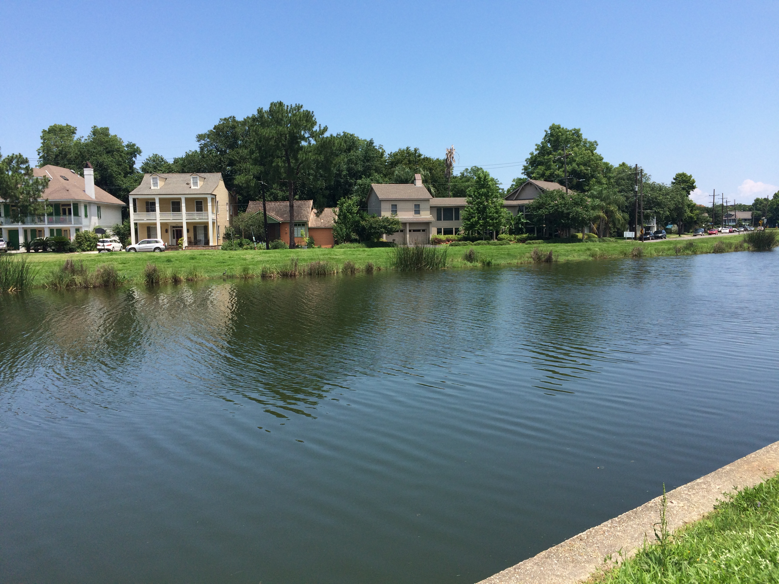
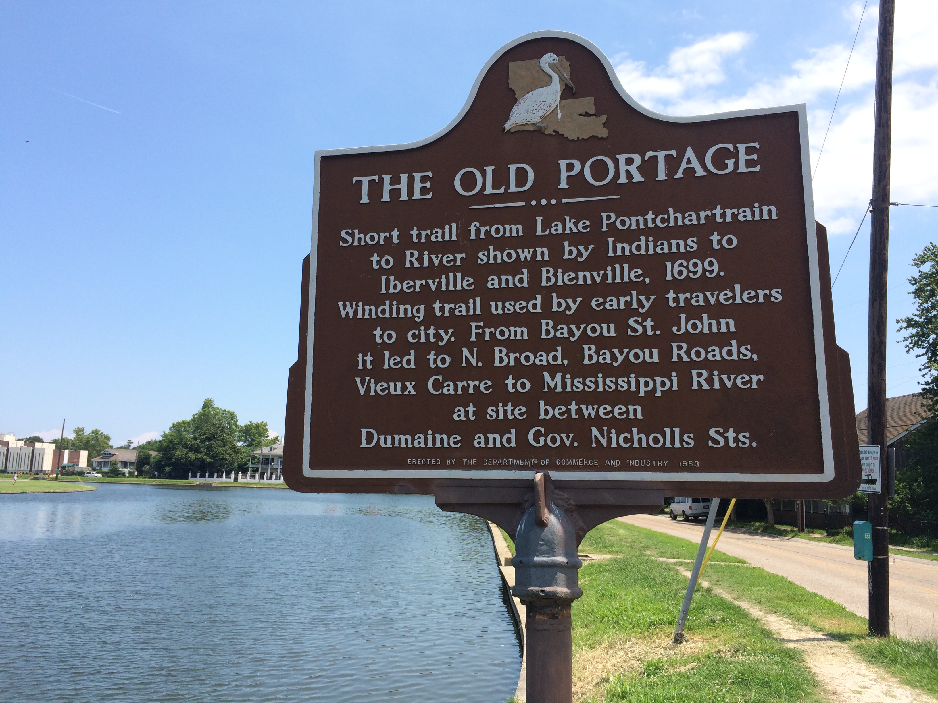
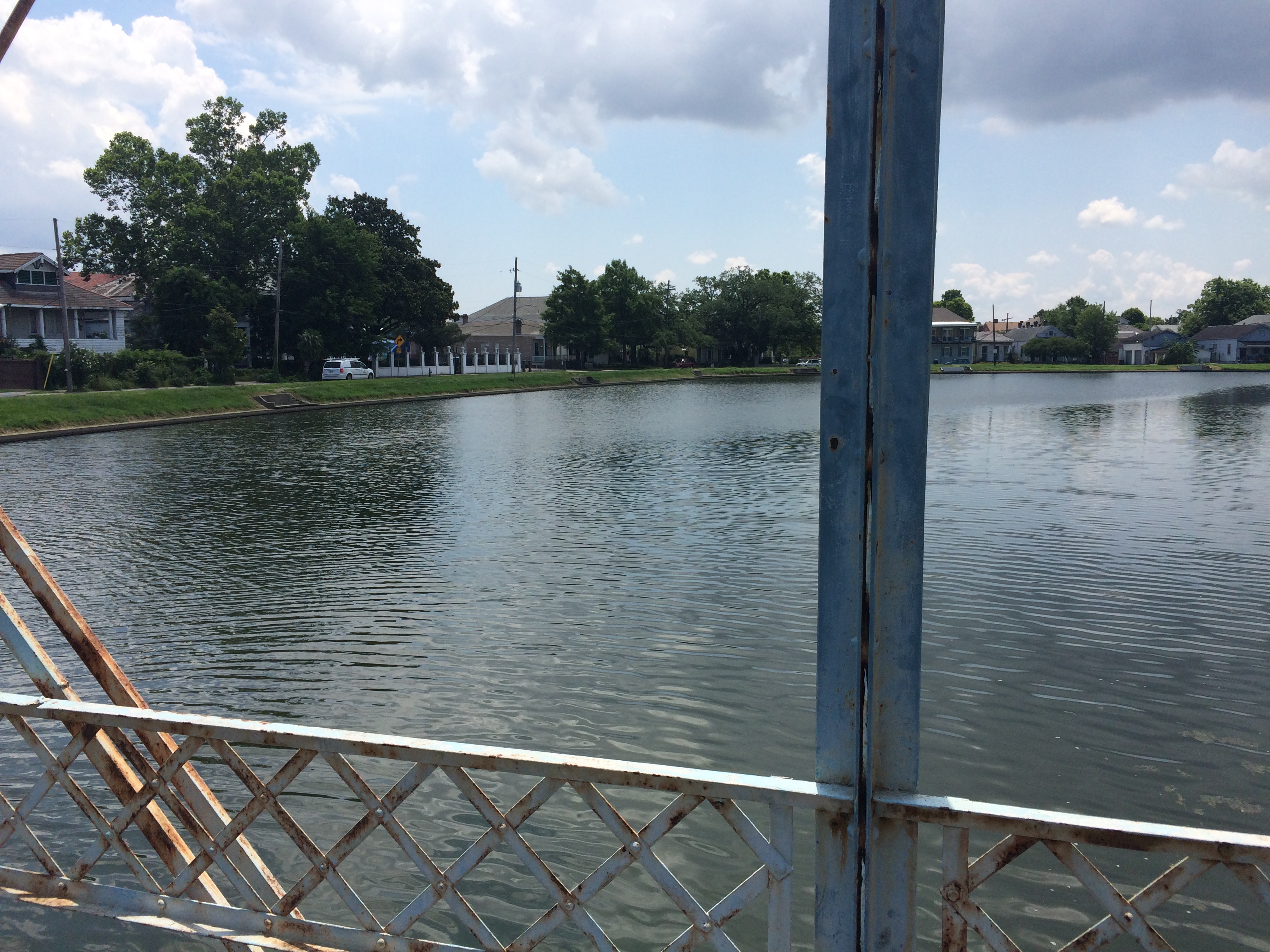
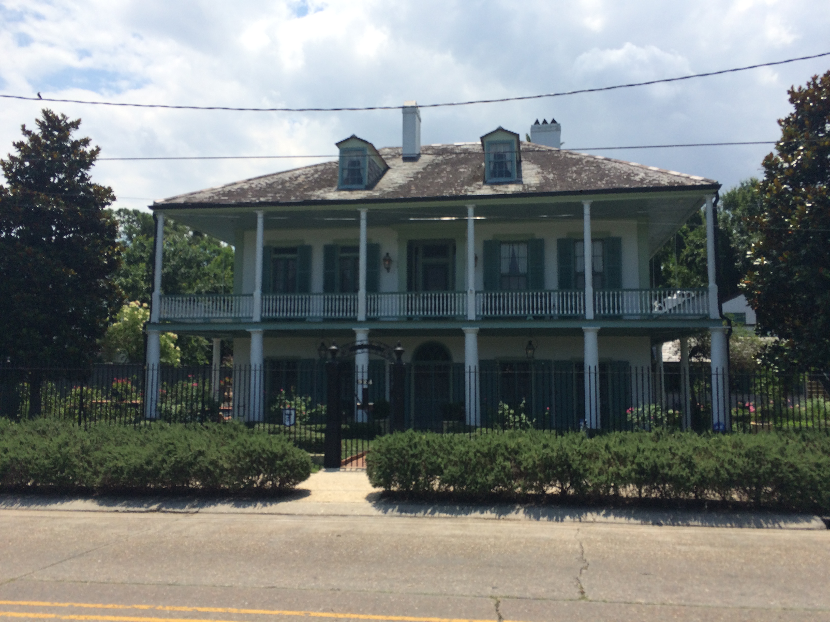
Last night, I was lucky enough to attend the annual St. John’s Eve voodoo head-washing ceremony, led by Sallie Ann Glassman’s La Source Ancienne Ounfo, an event that has taken place for the last twenty years on the historic Magnolia Bridge on the evening of June 23rd. Yours truly has a lot to learn about the history of voodoo in New Orleans—but I do know Bayou St. John has played an important role in that history, in part because the so-called Queen of Voodoo, Marie Laveau, was said to have acquired herbs and other ritual materials from the Native Americans living in the area, and in even larger part because on October 15, 1817, shortly after the influx of refugees from the slave uprising on Saint-Domingue (present-day Haiti) into New Orleans (an influx that helped solidify the cultural and religious practices of voodoo here), city officials banned congregations of blacks except for in specific locations at specific times. Therefore, many of these “secret rituals” were moved out to the bayou—to that relatively untamed, muddy-banked, cypress-forested waterway, surrounded primarily by farmland of varying degrees of sogginess. In my initial search for sources on this topic, I also heard it mentioned that the bayou, named after Saint John the Baptist, was a natural place to hold these St. John’s Eve rituals—but I’m not sure about that potential connection yet.

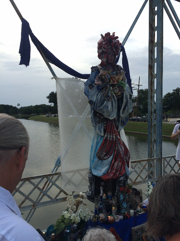
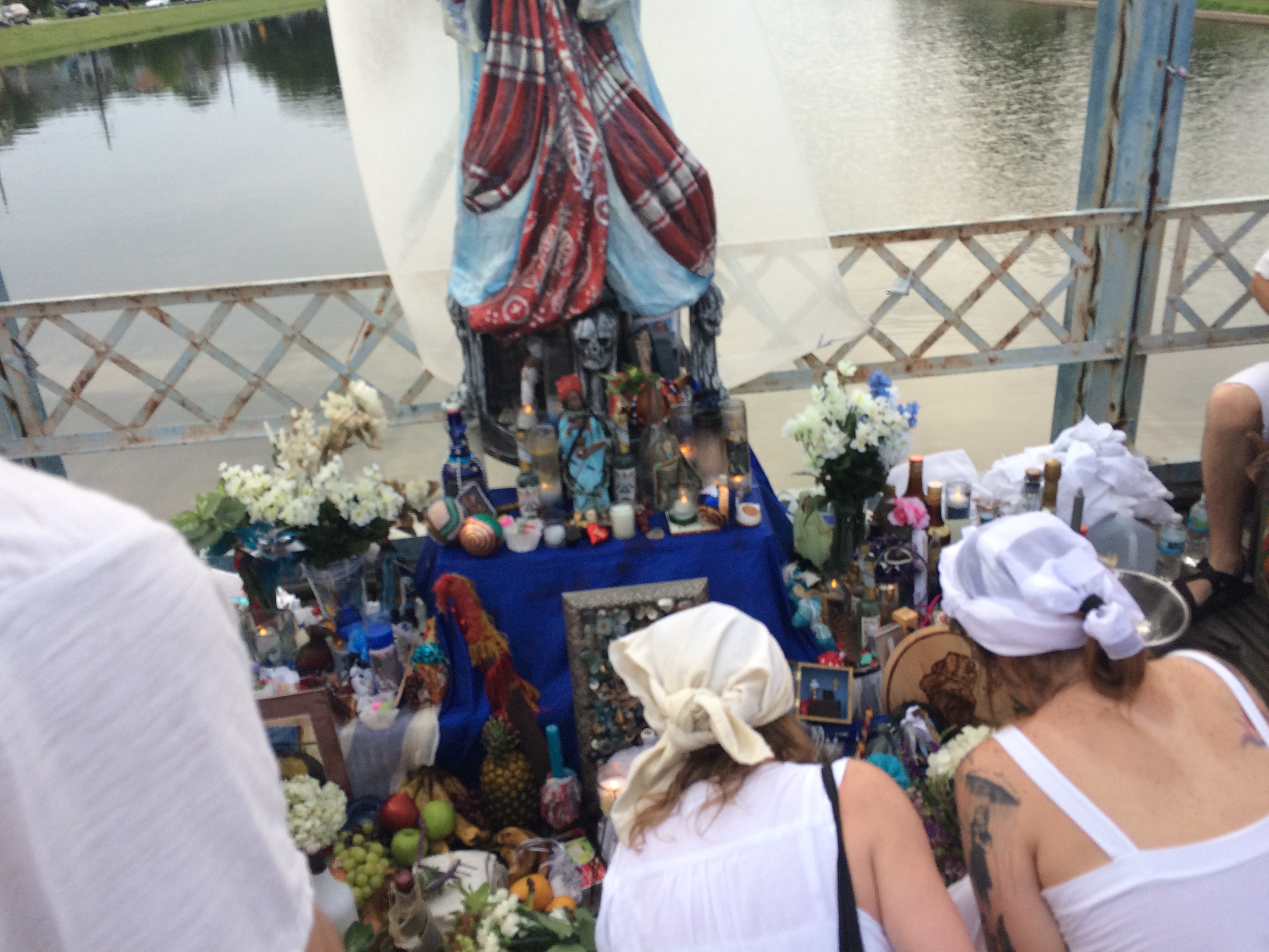
The head-washing ceremony, believed to be a modified (and perhaps modernized) version of a voodoo baptism, included chanting and singing, dancing, a colorful, 9-foot-tall papier-mache statue of Marie Laveau (produced by Mid-City Mardi Gras decoration designer Ricardo Pustanio) looming above a pile of miscellaneous offerings, a palm-ful of cool water poured from a green bottle that we all dabbed on our necks, and a bridge-ful of spirited folks dressed in white.

Oh! And I almost forgot to mention The Inappropriate Drone, who buzzed very loudly above the ceremony for what seemed like an impossibly long time, and the interaction between the older woman to my left who crossed to the railing of the bridge, located with her eagle-eyes the two young men who appeared to be controlling the drone, made her hand into the shape of a gun and pretended to shoot them (after already having flipped off the drone a few minutes earlier). The drone soon buzzed off. A very New Orleans moment.

BAYOU RAMBLINGS

“STATEMENT OF EVES LEGENDRE—WATCHMAN CHIEF

FEBRUARY 21, 1938

Mr. Richards,

Watchman John D. Thomas reported to me at his post #42 at 4:01am Feb. 20, at Orleans and Moss Streets, that a Ford car, license 191-659, ran into the pile driver which was standing crosswise on Moss Street completely blocking said st. There was a red lantern on each side of the driver. One lamp was broken.

Thomas phoned the police who took the man to his home. He was unhurt. I personally visited the police station and spoke with the officer who took him home. He said the man was unhurt and everything was ok. The driver’s name is Frank F. Collins, Address: Gretna, La.

The car was picked up by a wrecker.

(signed) Eves Legendre, Watchman Chief”

Um Mr. Collins, how did you miss the pile driver lying on its side across the entire width of the street, hung with red lanterns?? Was Mr. Collins a little tipsy??

In other news, here is a complete list of the creatively-named soils of New Orleans (from Richard Campanella’s Geographies of New Orleans):

commerce silt loam

commerce silty clay loam

sharkey silty clay loam

sharkey clay

frequently flooded commerce and sharkey soils

Harahan clay

drained Kenner muck

Clovelly muck

Lafitte muck

dredged aquents

frequently flooded dredged aquents

drained Allemands muck

Westwego clay

Gentilly muck

Lastly, a few of my favorite boat names recorded during a 1935 survey of permanently or semi-permanently moored vessels in the Bayou St. John:

“French Duck ”

“Black Cold”

“Bianca”

“I’m Alone”

“Birth of St. Louis”

“Little Bit”

“Honey”

and, my number one fav,

“Wispah”

WHAT THE BAYOU HAS TAUGHT ME SO FAR

What I’ve learned from my first week of research: enter research institution with a full stomach and an empty bladder; do not attempt to plan how long you’ll spend with any given source—you’ll never know what you’ll find, or where it will lead you, or the time required for s​uch adventures; I can’t remember what else I’ve learned, because I’m exhausted.

This past week I read about a ghost cemetery that once existed alongside the bayou, near the Lafitte Greenway. Not a cemetery full of ghosts—those are all over New Orleans—but a cemetery that has become a ghost itself: briefly in use in the mid-19th c. and then “filled in” (What does that mean? What did they do with the bodies??) after just two or three decades, due to a land dispute I need to learn more about. The cemetery was intended to be half Protestant, half Catholic, with each half further divided into sections for whites, free people of color, and slaves.

Mostly, I’ve been rifling through boxes filled with folders filled with tissue-thin letters written on typewriters from 1933-1936 about the WPA-funded Bayou St. John Aquatic Park Project—when that mucky, rubbish-filled, houseboat-infested water was swept clean of its refuse, dredged, leveed, straightened, decked out with grassy banks and flowering bushes and newly paved highways, strapped with fixed-span bridges.… No more ragamuffin children in underwear jumping from broken bridges! Only gondolas, and ladies in nice hats!

I don’t mean to make fun of those fine men whose letters back and forth to one another (letters, I imagine, that were dictated to secretaries as said men paced the floor, gesticulating wildly, like in the movies) I’ve been immersed in all week. The historian’s role is not to judge (but this is a blog, after all…). I actually might miss Walter Parker, Chairman of the Bayou St. John Improvement Association, once I have to move on to other sources. Walter Parker—a man with vision and persistence and the ability to persuade, who is largely responsible for the bayou we all know and love today….

P.S. I’m in the market for a cheap canoe, or a reliable floating-something of any kind, and a single paddle. (Oh! And a doggie lifejacket, size small!)

Photo credit: Lauren Gauthier. Magnolia Bridge, looking up.

MEET: "THE BAYOU BOOK"

Over the course of the next two years, in time for the New Orleans Tricentennial in 2018, I will be writing a narrative history of the Bayou St. John and its immediate environs (tentatively called Bayou St. John: A Brief History) to be published by The History Press. The History Press has published many local New Orleans authors, like my good friend Benjamin Morris for his book on the history of Hattiesburg, Mississippi, and Brian Boyles for his book New Orleans Boom and Blackout: One Hundred Days in America’s Coolest Hotspot.

I feel truly honored to have been given this opportunity to explore a small part of New Orleans’ vibrant history, a history I’ve engaged with extensively in my creative work, over the course of the next couple years. I know I will be meeting and learning from some of the city’s finest researchers, historians, and scholars—not to mention some of its most loyal long-time residents. My job will be to listen closely, to notice patterns, to get elbow-deep in files and archives, and to present it all as concisely and compellingly as possible.

Expect factoids and blog posts, tweets and photos! If you’re a New Orleans resident, and you come across someone or something that might be of relevance, don’t hesitate to reach out! It takes a village, especially for a project like this. I’d love to hear from you.

Without further ado, let me introduce you to the finest small water body in the whole of New Orleans: Bayou St. John!

The bayou flows south from Lake Pontchartrain alongside City Park; it’s like a skinny arm reaching down toward the crescent formed by the curve of the Mississippi, truncating in what could be considered the city’s center, in the Mid-City neighborhood of New Orleans.

Here I am (the blue dot), at one of the bayou’s little elbows.

The bayou—a recreational hotspot crisscrossed with historic bridges, lined with beautiful houses, host to several annual festivals and celebrations, etc. etc.—has played an important role in the cultural and geographic development of the city from the time of its founding to the present day. Each of the neighborhoods that have grown up around it, in their own way, tell an important piece of the greater narrative of the city’s history. More on all of this to come, of course.

For now, GEESE!

And a tantalizing snippet of info about the portage route stretching from the edge of the bayou to the rear of the French Quarter—a ridge of high ground, back when the city as we know it today was primarily swampland, that proved significant to the founding of the city in its present location.

A view from the historic “Cabrini Bridge,” or Magnolia Bridge, one of New Orleans’ oldest surviving bridges.

And one of the Bayou St. John neighborhood‘s historic houses, about which I hope to be learning more in the coming months.

Thank you for reading. More to come! Research officially begins tomorrow….