BRILLIANT ASSEMBLIES OF LADIES

Did you know that where the Pitot House and Desmare Playground sit now was once a 19th century pleasure garden called “the Tivoli”? Leonard Victor Huber in his New Orleans: A Pictorial History even calls it New Orleans’ first park. At that time, the area around the bayou was seen as a rural escape from the hustle and bustle of city living and boasted several pleasure gardens by the end of the 19th century—green spaces where residents could dance, drink, and mingle in true New Orleans fashion.


Pitot House

Field behind Desmare Playground

Edna Freiberg, in her book Bayou St. John in Colonial Louisiana 1699-1803, includes a description of Tivoli patrons by a Mr. John F. Watson, a Philadelphia man visiting New Orleans in 1804. He tells us how those visiting the garden would “walk out in the dust and walk home after ten o’clock at night” (I picture ladies in their finery trudging along Bayou Road, although I’m not exactly sure what he means here). He also mentions ladies “of the best families” dressed to the nines, arriving at the gardens in their ox carts. [1]

LSU professor Lake Douglas, in his fascinating book Public Spaces, Private Gardens, quotes another traveler to New Orleans in 1806, the Irishman Thomas Ashe: “Every Sunday evening, ‘all the beauty of the country concentrates, without any regard to birth, wealth, or colour…. The room is spacious and circular; well painted and adorned, and surrounded by orange trees and aromatic shrubs, which diffuse through it a delightful odor. I went to Tivoli, and danced in a very brilliant assembly of ladies.’” [2]

Douglas goes on to highlight Ashe’s phrase “without any regard to birth, wealth, or colour,” which speaks volumes when put into the context of Ashe’s wider study of 19th century New Orleans’ social customs surrounding gender, race, and class—which were complicated to say the least, and which could often be observed in microcosm in the city’s dance halls. More on this to come: I am attempting to learn more about Ashe, New Orleans’ “quadroon balls,” and the city’s relationship to race and gender more generally as it transitioned into the 19th century.

For now, I’ll just do a little poetic imagining. Beneath the traffic sounds of Esplanade, can you still hear the clopping arrival of those ladies in their ox carts? Can you smell the orange blossoms? Can you see the circular, lantern-lit pavilion set amongst the trees, and the couples strolling about in their fancy hats and walking canes and rustling skirts? When you look up, can you see the stars beginning to emerge around the edges of the evening clouds? Can you hear the music warbling in the breeze, distorted by the passage of hundreds of years and layers upon layers of history?

(This is me, hiding behind a cypress tree, imagining myself into the scene. I even put on my early 19th century dress with the high waistline for the occasion! Don’t ask me where the hill I’m standing on came from….it’s an illusion. I don’t have an ox cart (Uber?? Where are you??) so I’ll have to walk along Bayou Road to get home….)

1 .Edna Freiberg, Bayou St. John in Colonial Louisiana 1699-1803 (New Orleans: Harvey Press, 1980) 324.
2. Lake Douglas, Public Spaces, Private Gardens: A History of Designed Landscapes in New Orleans (Baton Rouge: Louisiana State University Press, 2011) 73.

A PICTORIAL TOUR OF THE LAFITTE GREENWAY

If you didn’t get a chance to make it out to the 10th annual  Lafitte Greenway hike last Saturday, well have no fear! I took lots of photos and notes for you!


The hike of the recently-opened bicycle and pedestrian trail that follows along the filled-in bed of the old Carondelet Canal (the waterway that connected Bayou St. John to the edge of the French Quarter from the 1790s until the early 1900s) began in Congo Square, at 10am sharp. Hundreds of sunscreened people milled about and formed groups around volunteer tour guides. One of the founders of Friends of Lafitte Greenway, Bart Everson, gave a short speech—and soon enough, the groups were off!

After crossing Basin Street, named after the turning basin where the Carondelet Canal once culminated, we began strolling down the Greenway. Volunteer tour guide Kevin Centanni (who recently purchased the abandoned 10th Precinct Police Station near Delgado and is teaming up with Susan Spicer to open a restaurant in the renovated space, hopefully sometime in the next few months) told us all about the following fascinating features as we walked along:


–The gravel path to the right of the Greenway, where the Lafitte Projects once stood, that gives a nod to the “lover’s lane” that once ran alongside the canal in its early days. City residents would escape the hustle and bustle of the French Quarter and stroll hand-in-hand along the canal, taking in the relative quiet and breathing in the fresh air. This pathway is lined with old stones reclaimed from foundations of demolished buildings that were once in the area.

–The old brick posts that once marked the entrance to the Lafitte Projects. Centanni reminded us that Iberville and Lafitte were once sister housing projects of a sort—one for whites, and one for blacks—across the street from one another.

–A soon-to-be-finished storm water retention pond (among others along the Greenway). Eventually, the pond will hold rainwater and allow it seep back into the surrounding land instead of being pumped out into Lake Pontchartrain.

–Something called an “eco-swale,” which Centanni defined as a “ditch with the right kinds of plants in it.” I don’t know much about how these special ditches function yet, but the idea is to plant native species there in order to promote filtration of runoff into the surrounding land.

–Mr. Fred’s garden, one of the first along the Greenway, behind the Sojourner Truth Neighborhood Center.

–An example of “permeable pavement,” which is just what it sounds like: pavement that allows water to seep through it so it can flow back into the ground instead of spilling off into streets and storm drains.

–The Broad Street pumping station and the open canal that empties into it, recently fenced off for pedestrian safety.

–The “stoplight graveyard” I mentioned in a previous blog post about the Lafitte Greenway (soon to be removed and turned into green space along the trail, says Centanni), where the city piles up broken stoplights and lightbulbs. Don’t the bulbs look like fish eggs?

–The small memorial for David Lee Thompson, who died when attempting to cross a bridge over the canal running alongside the Greenway last December. The bridges have been fenced off to try and prevent people from using them, but they remain in place.

-What?!? Public recycling receptacles in New Orleans?!?!

–Where the Lafitte Greenway passes below Bayou St. John: the spot where the bayou once flowed into the Carondelet Canal, where the top of the “L” met its bottom leg and shot off toward the Quarter. Well…it didn’t exactly shoot, but sort of trickled its way down there—often becoming clogged and impassable, exasperating residents and officials time and time again for decades.

–Sydney Torres’ property, stretching from Jefferson Davis toward Rouses, planned to become a high-end residential and retail space. 

–Some pretty impressive graffiti along the side of a building on Torres’ property.

–A fully-equipped bike repair station (!!!) next to Winn Dixie along the Greenway.

–Where the Greenway ends for the timing being, at N. Alexander Street.

–A pothole full of clam shells that sets me musing about the shells’ possible connection to Indian middens found in the vicinity of Metairie Road….

–And finally, the hike’s final stop at Second Line Brewing! It was a blast to hike the Greenway, learning about the corridor’s many-layered history as we walked along. If I missed anything, reach out and share!

One more thing: you know how I mentioned those hoards of sunscreened folks preparing to set off in Congo Square? Well I was not one of them. As in, I did not wear sunscreen, and ended up with a mega legging calf-burn! Embarrassing, but too funny not to share!

AN INTERSECTION’S ANCIENT ENERGY Pt. 2

A couple weeks ago, I posted on my favorite New Orleans intersection: where N. Dorgenois, Bell, DeSoto, Kerlerec, and Bayou Road come together—that many-triangled flurry of streets that calls out to me as I walk my dog or pick up a breakfast burrito from Pagoda Cafe. As of my last post, I’d discovered that the site where the Church of I Am That I Am and King and Queen Emporium stands today was also site of the former home of Daniel Clark, prominent Anglo merchant of the Spanish period and the guy responsible for buying up a bunch of plantations between Dorgenois and Bayou St. John and mapping out Faubourg St. John in 1809. But, as I dug deeper, I discovered there was far more to learn….

Based on colonial-era maps I’ve scoured, it looks like this intersection was the spot where two well-trafficked Indian trails merged from ancient times up until the French period. One of those was the path that led from Bayou St. John to the present-day French Quarter, that Bayou Road and Bell Street approximate today—the famous portage route that made New Orleans possible. The other path followed along Bayou Sauvage (or Bayou Gentilly, which followed the basic trajectory of present-day Gentilly Boulevard).

My most amateurish map to date! (Not to scale; everything is approximate.)

Based on written evidence and an appropriate dose of educated guessing, it would appear that where these paths came together, Indians from various tribes traded with one another—and this practice continued once Europeans arrived. According to historian Jerah Johnson, “New Orleans’ earliest, as well as its last, all-Indian market was held in an open area called the Place Bretonne at the conjunction of what are now Esplanade Avenue, Bayou Road, and Dorgenois, Bell, and DeSoto streets. It lasted, with gradually dwindling numbers of Indians after 1809 (when the opening of the Faubourg St. John separated it from Bayou St. John, which had been the main route the Indians followed into town), until the construction on that spot of the LeBreton Market building in 1867. Small groups of Indians still continued to sell goods there as well as in other parts of the city.”[1]

According to my research, Clark bought this parcel of land in 1804. He died in 1813 in his hip-roofed house that stood where the Church of I Am That I Am stands today. When he mapped out the future Faubourg St. John, he wanted this fan of streets to be the focal point of the neighborhood and called it “Place Bretonne.” Clearly, as Johnson mentions above, Clark’s decisions essentially closed off Native American trade connections between this site and Bayou St. John. After Clark’s death, the piece of land was sold to the city of New Orleans in 1836, and Johnson tells us a municipal market, called LeBreton Market, was then built on the site in 1867—which is the very same building the aforementioned church occupies today.

I’m still left wondering a bit about this site’s evolution. Did Clark, after buying up the land between Dorgenois and the bayou, simply build a house right where the Indian market had been? What did that look like when it was going down? And then what made the city decide to build a market there 60 years later, after the site had stopped being used for this purpose? Was its ancient past was well-known, and therefore the idea seemed obvious?

I don’t know yet whether there were more specific reasons for this evolution, but it seems to me that the Mississippi River might have everything to do with it. After it swung into its present channel, it left behind the Metairie-Gentilly ridge system that the Native Americans utilized, among many others, to traverse the landscape. Their movement along the ridges impacted the locations they chose for trade, and also influenced the founding of New Orleans in its present location. These pathways also influenced future streets (like Bayou Road) and plantation property lines like the ones that demarcated Clark’s land. Perhaps Clark wanted this site—an important intersection, a center of activity—for his own, and perhaps, after Clark was gone, the city recognized the site’s natural properties for what they were, and decided a municipal market simply belonged there.

LeBreton Market from Wikimedia Commons, 1938, by an uncredited WPA employee

LeBreton Market 1938, credits same as above photograph

Interior of LeBreton Market during WPA restoration, 1938; credit same as for above photographs

If any of you reading this know more about this intersection than I do, please reach out! All I know is the spot continues to buzz with energy—and now, when I walk my dog across Bayou Road’s brickwork, I can feel how ancient that energy truly is….


  1. Jerah Johnson, “Colonial New Orleans: A Fragment of the Eighteenth Century French Ethos” in Creole New Orleans: Race and Americanization, ed. Arnold R. Hirsch and Joseph Logsdon (Baton Rouge: Louisiana University Press, 1992) 39-40.

ANCIENT AND ODD-ANGLED: THE ROAD TO BAYOU ST. JOHN

Since moving to my new address on N. Dorgenois Street, my fascination with the charming and disorienting formation of streets between Esplanade, N. Rocheblave, Columbus, and Broad has only grown. Residents may know this spot as home to Pagoda Café, Club Caribbean, and McHardy’s Chicken.

From N. Dorgenois, facing Bayou Road and Bell Street. photo by author

Alongside King and Queen Emporium Itn’l on Bayou Road, facing where Desoto breaks off to the left. photo by author

This bizarre intersection has everything to do with the odd-angled Bayou Road, “the road, trace, or portage [that] predated the city, following a narrow strip of high land that led from the Mississippi River past Bayou Sauvage, called Gentilly, to an intersection with Bayou St. John”[1]. Bayou Road was the thread, some argue, that made New Orleans possible—by lending the French a “backdoor route” from the Gulf through Lakes Borgne and Pontchartrain, down Bayou St. John, along the elevated ridge Bayou Road occupies to the Mississippi’s banks. The French could perch along the river’s edge, and thereby control the entire massive artery, without having to fight their way up its tumultuous mouth.

New Orleans Architecture explains that the corridor of “Bayou Road, on both its left and right sides, served as frontage for a series of concessions made first by the Company of the Indies, then by the kings of France, and later, the Spanish Crown. Simultaneously to the laying out of the city [ the present-day French Quarter]…these tracts of land to the rear of the city were developed into habitations (plantations) with houses and outbuildings facing each side of Bayou Road, having orchards behind and cultivated fields extending to the swamps” [2]. Even after the neighborhoods flanking Bayou Road were developed according to orthogonal street grids in the 19th century onward, Bayou Road was left to continue on its ancient, crooked way—there were too many houses and buildings already oriented along its trajectory.

So, back to my favorite intersection! Where, like, seven irregular triangles touch noses! The energy of the spot kept pulling me in, but until I did a little extra research in order to write this post, I didn’t realize how truly charged it was.…

It turns out N. Dorgenois Street formed the boundary line between some of these Bayou Road plantations that were continually changing hands throughout the city’s early history.

Chains of title can be kind of dull, but, in brief, between 1723 and 1834 the swath of land between N. Dorgenois and Bayou St. John (broken up into various parcels) was owned by folks with surnames like: Française, Langlois, Lebreton, Brasilier, Chalon, Almonester (the city’s wealthiest resident by the mid-1780s), Blanc, Vidal, Suarez, Clark, and Blanc again, until “…on September 26, 1836, Blanc sold to the Corporation of the City of New Orleans his ‘land or plantation, irregularly shaped having about twelve arpents frontage on Bayou St. John and bound by said Bayou, Carondelet Canal, Bayou Road, and Dorgenois…for $50,000’”[3].

Until around the time of the Louisiana Purchase, the particular sliver of land between N. Dorgenois and Broad was cultivated, but had no structures on it yet. Then comes Daniel Clark, Jr., the man who wanted to turn the land between the bayou and Dorgenois into Faubourg St. John. Historian Lawrence Powell tells us more about Clark: “…a young Philedelphian named Daniel Clark, Jr., Irish-born and Eton-educated, parlayed fluency in French and Spanish to become Governor Miró’s English translator, and then used that position to facilitate an illegal tobacco trade in which the governor silently partnered with Clark’s uncle, a wealthy Baton Rouge planter and New Orleans merchant. The younger Clark soon amassed a fortune from shipping and real estate, in the meantime joining the ranks of the slave-holding gentry”[4]. Later Powell tells us the two Daniel Clarks were some of the city’s largest slave-importers during the latter half of the 18th century.

Daniel Clark’s daughter, Myra Clark Gaines, stalled the development of Faubourg St. John after Clark’s death for close tosix decades via “the longest-running lawsuit in the history of the United States court system”(!!!) claiming she was the sole heir to his properties. (More on this fascinating lawsuit to come!) Before he died, Clark had succeeded in subdividing the faubourg into 35 irregularly-shaped blocks, however, and had envisioned the focal point of the neighborhood to be the fan-like formation of streets that inspired this blog post. New Orleans Architecture tells us that Clark built his country seat at the juncture of Bell, Desoto, and Bayou Road, roughly where King & Queen Emporium International is today. He died in the house in 1813 and it “ultimately fell into ruin and was demolished” [5].

So now we know a bit about the mainstream history of this tangle of streets in the 7th Ward. In my next post, I will seek to explore the little-known, less-recognized facets of this intersection’s history.…

1. Roulhac Toledano and Mary Louise Christovich, New Orleans Architecture Volume VI: Faubourg Tremé and the Bayou Road (Gretna: Pelican Publishing Company, 1980) xi.
2. Toledano and Christovich, New Orleans Architecture, xi.
3. Toledano and Christovich, New Orleans Architecture, 54-56.
4. Lawrence N. Powell, The Accidental City: Improvising New Orleans (Cambridge: Harvard University Press, 2012) 194.
5. Toledano and Christovich, New Orleans Architecture, 56.

NEW ORLEANS’ FIRST CARNIVAL MASQUERADE

Imagine this: the year is 1730. You’re a 22-year-old clerk for the French Company of the Indies, and you’ve recently been sent from Paris to the new fledgling colony of Louisiana to be a bookkeeper in New Orleans, the colony’s capital. In what’s now the present-day French Quarter, a basic street grid extends a few blocks back from the river, populated by a handful of brick-between-post timber structures shellacked with lime made from crushed oyster shells. Untamed wilderness threatens to overtake the town from all sides. Un-penned pigs wander the streets. The air is thick with mosquitos. Here and there, crumbling ditches have been dug to help with drainage, but still—after a hard rain, the city streets blur into a series of shallow muddy lakes.[1] All around you, colonists are panicking. Violent conflicts between the French and the Natchez tribe upriver have set everyone on edge. At the tavern, talk of the Indians and slaves banding together and murdering colonists in their sleep is all you seem to hear. And yet, it’s Carnival season! And you’ve barely had alickof fun!

In 2004, The Historic New Orleans Collection acquired the unpublished manuscript of one Marc-Antoine Caillot, clerk for the French Company of the Indies, that details his time spent in New Orleans between 1729 and 1731. What resulted is a beautiful collaboration between Erin M. Greenwald, Teri F. Chalmers, and many scholars and researchers calledA Company Man: The Remarkable French-Atlantic Voyage of a Clerk for the Company of the Indies, published by The Historic New Orleans Collection in 2013. For anyone interested in this era of our city’s history, I highly recommend this book. For our purposes today, we’ll focus on the section of the manuscript devoted to a Lundi Gras celebration along the banks of—you guessed it!—our very own Bayou St. John!

Before we get to Lundi Gras, though, Caillot gives us a glimpse of what the area around Bayou St. John might have looked like in 1730: “At three-fourths of a league’s distance on the left you will find a hamlet called Bayou Saint John, where there live five or six inhabitants very rich in livestock.” Greenwald’s footnote explains: “In 1727 the population along Bayou Saint John totaled 121, including forty-one whites, three indentured servants, seventy-three blacks, and four Indian slaves.”[2]Caillot was probably referring to those several landowners that had settled their large concessions along the bayou’s banks in the early years of the 18th century, resulting in a rural “hamlet” consisting of those landowners’ families, servants, and slaves.

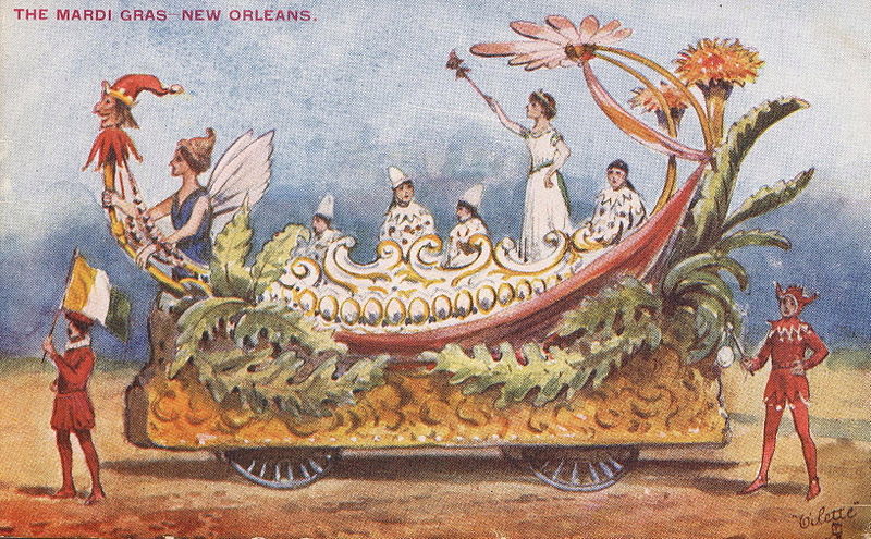
Ok, back to the Lundi Gras revelry. Caillot explains: “We were already quite far along in the Carnival season without having had the least bit of fun or entertainment, which made me miss France a great deal…. The next day, which was Lundi Gras, I went to the office, where I found my associates, who were bored to death. I proposed to them that we form a party of maskers and go to Bayou Saint John, where I knew that a lady friend of my friends was marrying off one of her daughters….”

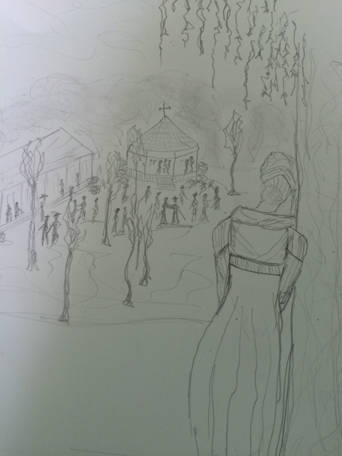
Caillot explains that his associates were like, Oh cool, yeah that sounds fun…it’d be cool to crash the wedding party…but uhhh we don’t have anything to wear! and kind of lost motivation to make it happen. “But, upon seeing that no one wanted to come along, I got up from the table and said that I was going to find some others who would go, and I left.” Caillot couldn’t be deterred. “…I did not delay in assembling a party, composed of my landlord and his wife, who gave me something to wear. When we were ready and just about to leave, we saw someone with a violin come in, and I engaged him to come with us. I was beginning to feel very pleased about my party, when, by another stroke of luck, someone with an oboe, who was looking for the violin, came in where we were, to take the violin player away with him, but it happened the other way around, for, instead of both of them leaving, they stayed. [Doesn’t this sound like just the kind of Carnival fortuitousness we’re used to in modern-day New Orleans?! An impromptu party, and then some guy with a guitar just happens to walk by….] I had them play while waiting for us to get ready to leave. [Oh, we all know this story: the hours and hours it takes for everyone to get out of the house and to the parade!] The gentlemen I had left at the table…came quickly upon hearing the instruments. But, since we had our faces masked, it was impossible for them to recognize us until we took them off. This made them want to mask, too, so that we ended up with eleven in our party. Some were in red clothing, as Amazons, others in clothes trimmed with braid, others as women. As for myself, I was dressed as a shepherdess in white. I had a corset of white dimity, a muslin skirt, a large pannier, right down to the chemise, along with plenty of beauty marks too. [Love the attention to detail. This is what a good Carnival costume requires.] I had my husband, who was the Marquis de Carnival; he had a suit trimmed with gold braid on all the seams. Our postilion went in front, accompanied by eight actual Negro slaves, who each carried a flambeau to light our way. It was nine in the evening when we left.” [3]

On the way to the bayou, presumably along the path occupied by present-day Bayou Road, the travelers came upon several bears, which they scared away with the flambeaux. When they got to the bayou, they sent a slave to go check out the wedding party and see what was going on—as in, are they done with all the boring parts yet? Are they dancing yet or not?

The slave returned with the news that, yes, they had just begun dancing. “Right away, our instruments began playing, the postilion started cracking his whip, and we walked toward the house where the wedding celebration was taking place.” Caillot goes on to describe the wedding party receiving them with excitement, requesting that they join in and dance, and then forcing them to finally remove their masks. Everyone was recognized very quickly, aside from our cross-dressing young friend: “What also made it hard for people to recognize me was that I had shaved very closely that evening and had a number of beauty marks on my face, and even on my breasts, which I had plumped up. [!!!] I was also the one out of all my group who was dressed up the most coquettishly. Thus I had the pleasure of gaining victory over my comrades, and, no matter that I was unmasked, my admirers were unable to resolve themselves to extinguishing their fires, which were lit very hotly, even though in such a short time…”[4]. Our narrator was so sexy and convincing as a lady, the menfolk in the crowd were hard pressed to “extinguish their fires”!

To hear more about the festivities that took place on this 1730 Lundi Gras, and to experience more of Caillot’s adventures, go findA Company Man. And when you go out this Lundi Gras, perhaps you’ll plump your breasts with a little extra gusto—and contemplate, on your way to the parades, some of the ingredients of our city’s founding: the violence, the distribution of power, the bizarre revelry….

1. Lawrence N. Powell, The Accidental City: Improvising New Orleans (Cambridge: Harvard University Press, 2012) 66-68.
2. Marc-Antoine Caillot, A Company Man: The Remarkable French-Atlantic Voyage of a Clerk for the Company of the Indies, ed. Erin M. Greenwald, trans. Teri F. Chalmers (New Orleans: The Historic New Orleans Collection, 2013) 82.
3. Caillot, A Company Man, 134-135.Caillot, A Company Man, 135-136.

LOAFING ROWDIES AND GOOSE RACES

This past New Year’s Eve, there was no shortage of conflict between revelers and police along Bayou St. John. I personally witnessed a city garbage truck chow down on a wooden barge that was to be set into the bayou near Magnolia Bridge and lit on fire—an extension, perhaps, of the debates over New Year’s Eve bonfires in Mid-City over the past decade.

The bayou, you may not be surprised to learn, has been the site of many “fringe rituals” over the centuries—as well as plenty of city-sanctioned recreational activities too, of course. New Orleans seems to specialize in these kinds of tensions; apparently we simply cannot resist the opportunity for a bit of fun, no matter the potential repercussions.…

In perusing the City Engineer’s Bridge Records from 1918-1967 this past summer, I found a letter from Walter Parker, Chairman of the Bayou St. John Improvement Association and future New Orleans mayor, to Honorable George Reyer, Superintendent of Police, dated April 10, 1934:

“It would help a great deal were some of your men to pass along the Bayou as frequently as practicable. Some boys who do not have bathing suits, do not hesitate to bathe in very scant underwear. At the Dumaine Street bridge many boys make the dangerous practice of climbing on the bridge structure. At the Magnolia Bridge (Harding Drive) boys dive from the top of the bridge pretty much all day. In so far as I know, people have a right to fish on the Bayou. But when they leave crab bait, old papers and remnants of lunch behind, they create a nuisance. I have found that such things usually are the result of thoughtlessness rather than viciousness, and a simple request or word of warning brings a correction….” [1]

Many of you have probably heard about the annual St. John’s Eve voodoo ceremony that takes place on the Magnolia Bridge every June 23rd. Bayou historian Edna Freiberg explains that after the Haitian Revolution, New Orleans authorities began to get jittery about potential slave uprisings in their own city. On October 15, 1817, City Council forbid people of color from congregating in large groups “except in times and places specified by authorities.” [2]

Following this mandate, voodoo rituals moved to the untamed upper bayou, along the shores of Lake Pontchartrain, where the authorities wouldn’t be as likely to quash them. The voodoo rituals performed on the bayou today may be an extension of these religious ceremonies pushed to the fringe by the powers that be. (More on this when I conduct in-depth research on the subject.)

Aside from the recreational pursuits of the New Orleans elite in the 19th and early 20th centuries (rowing races for which thousands of finely-dressed spectators turned out during the summer months; picnics at Magnolia Gardens, where visitors could purchase beer and ice cream; sketching parties on the bayou’s banks; a “young ladies rowing club,” complete with “costumes” and “chaperones”; and “pleasure drives” along the shell road to Lake Pontchartrain, to name a few), neither was there a shortage of ad hoc recreational events along the bayou during those years, some deemed more acceptable than others.

Readers may remember a “strange duel” I mentioned in a previous post, for example.

Or take this Times-Picayune piece from June 20, 1872, in which a set of “loafing rowdies” are up to no good: “The attention of the police is called to the fact there is a crowd of men who daily congregate on or about the bridge over Bayou St. John and demean themselves most disgracefully. They appear to find especial pleasure in making use of the vilest sort of language, yelling, singing unchaste songs, and insulting persons whose necessities carry them in that direction. This sort of thing has grown to be an intolerable nuisance, and should be abated at once. Bayou St. John is one of our most popular afternoon promenades during the heated term, and the ladies and gentlemen who seek recreation and pleasure at that point are entitled to a share of police protection from the misconduct of loafing rowdies. It is suggested that one or more officers be stationed near the bridge, day and night, as the services of the police are very often needed by the residents in the neighborhood.”[3]

And one of my favorite examples, from 1876: “A goose race is proposed to come off at Bayou St. John next Sunday. There will be several contestants, each in his tub, which will be drawn upon the water by six geese. There distance will be one hundred yards.”[4] Does anyone else feel like a hundred yards is actually pretty far to travel via goose-drawn tub?

Or an example of the kind of entertainment one might hope to find on a summer’s day at Spanish Fort: “Prof. Clark, the renowned swimmer, appears again this evening and to-morrow in a series of difficult feats on water at the lake end of Bayou St. John. This novel exhibition is to include eating, drinking, and writing under water; also a military drill by the skillful Professor. To the end of providing for the many going, the cars of the City Park and Lake Railroad will run every half hour without fail.”[5]

Lastly, although this is a bit of a stretch, I wanted to include the strange recreational habits of a Mrs. Taylor Shatford, who lived for a time on Bayou St. John: “It was in 1916, after a trip abroad, that Mrs. Shatford became convinced that she was controlled by the spirit of Shakespeare. Operating with a ouija board she began to take dictation from him, and later declared she had trained her psychic senses…and could actually hear the words from his ghostly lips.”

The article provides us with a snippet of The Bard’s genius-beyond-the-grave, via Shatford’s ouija board: “‘We carry here the man we were. Our longings, like, some hatreds as of yore. And I who wove my rhyme am he, the same, except for my soul’s tears. To all who yearn to know if still man lives without his bones I say Complete. He dies never. His ashes are remnants of his suit. I have my whiskers still.”[6]

See?! Even the long-dead William Shakespeare can’t resist shenanigans the bayou every now and again!

1. New Orleans City Engineer’s Bridge Records, 1918-1967, City Archives Louisiana Division, New Orleans Public Library
2. Freiberg, Edna B., Bayou St. John in Colonial Louisiana 1699-1803. (New Orleans: Harvey Press, 1980) 294.
3. “The City. Public Hacks and Hack Drivers. Their Condition And Future Prospects.” Times-Picayune 20 Jun. 1872: 2. NewsBank. Web. 13 Jan. 2016.
4. “City Gossip.” Times-Picayune 29 May 1876: 2. NewsBank. Web. 13 Jan. 2016.

5. “Aquatics At Spanish Fort.” Times-Picayune 14 Jul. 1876: 1. NewsBank. Web. 13 Jan. 2016.
6. “Spirit Of Shakespeare Works Through Medium Revelations of Poet Made in New Orleans to “Medium.” Times-Picayune 11 Jan. 1920, |: 33. NewsBank. Web. 13 Jan. 2016.

THE SPANISH FORT AND ITS MANY HATS

In learning recently of a 2013 archaeological dig at the colloquially termed “Spanish Fort” site on Bayou St. John, my fascination with this spot was renewed. The dig, conducted by FEMA, revealed a Native American shell midden peppered with fragments of animal bones, pottery, clay pipes, and other artifacts dating from the late Marksville period, from around 1,600-1,700 years ago.

Instead of destroying it entirely, as early colonial accounts had suggested they’d done, the French simply sliced off the top of the midden and used it as a foundation for the wooden fort they built there in 1701. The Spanish then reinforced the fort in the latter half of the 18th century, and the Americans reinforced it still further in 1808.

Although the fort never saw much military action, the piece of land it sits on has seen an astounding amount of human activity over the past 2,000 years. Throughout much of the 19th century, the site was a popular spot for picnics and swimming, boasting a resort hotel catering to New Orleans elite looking to escape the city and spend an afternoon on the shores of Lake Pontchartrain.

After a fire destroyed the hotel in 1906, the New Orleans Railway and Light Company built an amusement park that drew New Orleanians to the site by the thousands. By the 1920s, activity at that crook of land between Bayou St. John and the lake began to decline when the Orleans Levee Board began their extensive Lakefront Project, “reclaiming” land from the lake in Orleans Parish and fortifying it with a sea wall.

That’s a lot of activity for one small slip of bayou bank! The site has “worn many hats,” you might say—first a shell midden hat, then three different kinds of fort hats, then a hotel hat, then an amusement park hat…. What a stylish and versatile hunk of mud! Such elaborate head-pieces!

What follows are some quotations and photographic snippets of these many layers of Spanish Fort history.

From the Library of Congress, a 1934 photo taken as part of the Historic American Buildings Survey. Look at all those layers of fort!

A notice posted by Louis Lacuna & Co. in the July 4, 1841 Times-Picayune:

The fine Hotel at the Lake end of the Bayou St. John is now ready for the reception of visitors, having every variety for amusement—Billiards, pistol shooting, bathing, &c. The Restaurant is furnished with the best the markets afford.”[1]

From Wikimedia Commons, a circa 1883 drawing of the Spanish Fort by Mark Twain (!) from his book Life on the Mississippi.

From a book written by Eliza Ripley, called Social Life in Old New Orleans, published in 1912, we have a description of the “Lake End” resort and what its fine dinners can do for a person’s femininity:

“There was a large hotel (there may be still—it is sixty years since I saw it), mostly consisting of spacious verandas, up and down and all around, at the lake end of the shell road, where parties could have a fish dinner and enjoy the salt breezes….The old shell road was a long drive, Bayou St. John on one side, swamps on the other, green with rushes and palmetto, clothed with the gay flowers of the swamp flag. The road terminated at Lake Pontchartrain, and there the restful piazza and a well-served dinner refreshed the inner woman.”[2]

(In reading this, I can’t help but wonder if that shell road was paved with shells dredged from the midden at the Spanish Fort site….)

On December 30, 1913, the Times-Picayune ran a full-page ad for New Orleans Railway and Light Co., in which the new amusement park was mentioned:

“SPANISH FORT: A historical spot situated on the lake shore at the junction of Bayou St. John. A delightful resort, operated in summer with music, vaudeville and light opera. Full of romantic reminiscence,—a beautiful spot, shaded with an abundance of trees and other shelters. In the summer there are many attractions, various amusement devices, restaurants, casinos, and ice cream parlors. An excellent electric train service from Canal and South Rampart St.”[3]

Some Spanish Fort diners in a Library of Congress photo titled “Afternoon scene of Reno’s Restaurant,” dated May 27, 1912. I love being able to see the movement of passersby just off the patio to the right….

From Wikimedia Commons: “‘Fitchenberg’s Penny Arcade’ at Spanish Fort amusement park, New Orleans, circa 1910,” photo by John Norris Teunisson.

Lastly, a rollicking description of the Spanish Fort amusement park in its later years from the Times-Picayune, June 8, 1924:

“NEW RECORD MADE AT SPANISH FORT—Popular Lake Resort Reports Heaviest Attendance in Its History—The last week witnesses a new record for crowds at Spanish Fort amusement park. Despite the rain thousands of Orleanians attended the dances at Tokio Gardens and made a round of the various amusements and concessions, including the Giant Dipper, the Dodgem, the Whip, the Caterpillar, the Merry-Go-Round, the Penny-Arcade and other attractions. As usual Emile Tosso and his concert band drew a heavy patronage….Tokio Gardens continues to be the center of attraction of the younger dancing set of the city, and any night until midnight hundreds of dancers attend. Of all the thrilling attractions at the park, the Giant Dipper seems to have the most appeal. The thriller is a mile long and is negotiated at the rapid speed of 57 seconds. Second in popularity is the Dodgem, which has all the excitement of a railroad wreck with none of the dangers. The Whip, next in choice of the crowds, is the famous ride first established at Coney Island. The Caterpillar is especially popular with young couples. It consists of riding under cover in the dark at a rapid speed in an artificial cyclone.…With the increase in temperatures many persons are finding relaxation at Tranchina’s bathing pavilion where all facilities for an enjoyable swim are at hand, including dressing rooms, towels, lockers, bathing suits and other equipment, such as slides and chutes of the finest type.…”[4]

Shooting through the darkness with one’s sweetheart “at a rapid speed”—that Caterpillar sounds positively scandalous!

From Wikimedia Commons, before the Lakefront Project extended the lake shore: “Aerial photograph of Spanish Fort Amusement Park, New Orleans, 1922. Showing intersection of Bayou St. John and Lake Pontchartrain, “camp” houses on piers in the shallows of the lake, and undeveloped (pasture) land to the south.”

There are many mysteries associated with the Spanish Fort that I didn’t get into today—like the unmarked grave enclosed by an iron fence at the site, or the unidentified Civil War submarine that was hoisted from the bottom of the bayou next to the fort over a century ago, now housed in the Louisiana State Museum in Baton Rouge, or the strange rock sculptures that may be associated with the amusement park of yesteryear still visible to those driving by….

If this doesn’t inspire you to visit the quiet, unassuming Spanish Fort ruins of today—in order to imagine the waves of activity the site has witnessed over the years—then I don’t know what will!

1. Times-Picayune 4 Jul. 1841: 3. NewsBank. Web. 16 Dec. 2015.
2. Ripley, Eliza Moore Chinn McHatten,Social Life in Old New Orleans, Being Recollections of My Girlhood.(New York; London: D. Appleton and Company, 1912) 63.
3. Times-Picayune 30 Dec. 1913: 24. NewsBank. Web. 16 Dec. 2015.
4. Times-Picayune 8 Jun. 1924: 67. NewsBank. Web. 16 Dec. 2015.

A LOVE LETTER TO LAKE PONTCHARTRAIN

Lake Pontchartrain, I’ve underestimated you. Or at least largely ignored you while I’ve lived in New Orleans—and you know what, it’s my loss. There’s something somewhat static or expected about the idea of a lake. Many of the lakes in Maine, where I’m from, could very well have more interesting hydrologic histories than I was ever aware of growing up (ancient freshwater trapped in glacial scars, no doubt), but for the most part, I tend to think of lakes as bodies of water with relatively low variability. Large puddles, essentially, that one can take a kayak or a rope swing to. Primarily unchanging, potentially polluted (not naming any names), and probably mucky on the bottom.

Lake Pontchartrain, none of these things describe you! You are technically a lake, if a lake is defined as a body of water surrounded by land, but that is definitely not the best term for you. No, you are an estuary, one of the most productive types of ecosystems on the planet, thank you very much. Until recently, I thought an estuary was simply any brackish body of water—and that still may be true—but a more accurate definition of an estuary is the place where a river meets the sea, where freshwater and saltwater swirl together. That liminal place where a river is in the process ofarriving. Maybe many of you readers already knew this about Lake Pontchartrain—but I didn’t, so bear with me!

As I’ve described in a previous post, Lake Pontchartrain was formed a few thousand years ago by the interplay between a swinging arm of the Mississippi River (before it landed in its modern channel) and a relict, now-buried barrier-island chain that swoops along its southern border like a pearl necklace. Although that former Mississippi wanted to swing north, toward the center of the present-day lake, the sandy island chain prevented it from doing so and it was forced to continue on its northeastern trajectory, forming an oval of earth-trapped seawater in the process. It would have sealed off the lake altogether, but it turns out the Mississippi wasn’t the only river in town. What about the TangipahoaTchefuncte, and Bogue Falaya rivers, coursing into the lake from the north (badass rivers in their own right, boasting rich Native American histories)? They continued to empty their insides into our friend LP, and the water had to go somewhere! A river, no matter how small, must always make its way to the sea. The freshwater forced its way through the eastern edge of the lake, eventually forming the Rigolets and allowing salt water to enter in and out when it pleased. So, to say this another way: Lake Pontchartrain serves as an estuary for three very respectable rivers. When’s the last time you could claim anything nearly as cool?

Lake Pontchartrain, you aren’t just connected to those Northshore rivers and the Gulf via the Rigolets, however. You connect to the Gulf via the Chef Menteur Pass, too, and Lake Maurepas via Pass Manchac. Now you even touch the modern Mississippi herself—via the Bonnet Carre Spillway and the Industrial Canal. And, since 2014, you connect to the Bayou St. John again! The metal door that had been shut tight between you for decades is now open, at least intermittently. You remind me of a broad, shallow heart, pumping water—salty and fresh—in and out of your various pathways and conduits, continuously.

You’re a bit under the weather though, I should mention. Your wetlands are sediment- and freshwater-starved. You’re suffering, as this whole region is, from a lack of Miss River nutrients. It wasn’t always this way.

Lake Pontchartrain fun-facts:

LP touches six Louisiana parishes! St. Tammany, Orleans, Jefferson, St. John the Baptist, St. Charles, and Tangipahoa.

Its average depth is only 12-14 feet!

Its bridge, the Lake Pontchartrain Causeway, is the longest (continuous) bridge over water in the world, according to the Guinness Book of World Records. It’s also featured in this 1988 ode to New Orleans, by Lucinda Williams, which is what I will leave you with….

CASCADES OF ENERGY: A WHIMSICAL TAKE

These bayou posts have become a way for the two sides of my writing life to converge: the history and the poetry, the “reality” and the imaginary. See below for an example of what I mean.

My favorite part of Sherwood Gagliano’s “Geoarchaeology of the Northern Gulf Shore” is when he talks about natural systems: “Natural systems are defined by recurring patterns of flow of energy and materials on, or near, the earth’s surface. These energy flows or fluxes are most commonly in the form of fluid movement (water, ice, wind, etc.) but may also be through chemical processes. Energy flow is the integrating factor that defines the natural system.”[1 ]In New Orleans, we are part of a deltaic coastal “cascading system.” We live at a point of interaction between deltaic and coastal forces—where fresh water and salt water meet: “a chain of systems…dynamically linked by a cascade of energy.”[2] This energetic formula defines our geography, and therefore our history. I love the word “energy” because it’s both scientific and whimsical in its usages. Another convergence. Let’s follow it!

Around where the Bayou St. John meets Esplanade Avenue, near the entrance to City Park: this place is its own energetic system, according to me. The phenomena, geological and historical, that have unfolded at this location over the last few thousand years have charged it up so much that next time you’re there—crossing over the bridge to go to the NOMA, for example—you might be able to feel it. Let me give you the briefest of brief histories about this particular spot:

When the planet warmed after the last ice age, the frozen water that had spread across our continent began to melt, flushing into a massive declivity in the landscape called the Mississippi Embayment and flowing down to the Gulf, bringing with it monumental amounts of sediment. The sediment accumulated until it rose up out of the sea and formed its own land. Anywhere this proto-Mississippi River went, it built the land beneath itself higher and higher. Eventually, with the help of gravity, it would slice through its own banks and find a more direct path to the sea. In this way, the Mississippi has been building and swinging, building and swinging, for thousands of years. For a while, before it swung toward its current path 700 years ago, a main arm of it flowed west to east from present-day Kenner, through the heart of New Orleans, out to present-day New Orleans East.[3]

They call this, among other similar names, the Metairie-Sauvage distributary. This former limb of the Mississippi River is crucial to our tale. For one thing, it built up the relatively high, well-drained Metairie-Gentilly ridge system (which, along with the Esplanade Ridge, was crucial to our city’s early history) through the alluvial process outlined above. It also spawned (gasp!) the bayou itself! Near where modern-day Esplanade Avenue nears City Park, this former distributary meandered…sharply. No one quite knows why it did, but we do know that in the process of meandering it sent yet another distributary southward (a body of water simply called the Unknown Bayou, that would eventually form Esplanade Ridge) and another, smaller distributary northward, toward the lake (the Bayou St. John!). For some inexplicable reason, the Metairie-Sauvage distributary split into three, irregular fingers at this location—and thank goodness it did!

Here’s another theory about the bayou’s birth, since what I’ve explained above is not 100% certain: it’s possible that after the Mississippi chose its current path 700 years ago and the Metairie-Sauvage course was abandoned, becoming a sluggish bayou in the process, the Bayou St. John formed as a drainage conduit for this larger bayou. At a weak point in the natural levee (around where present-day Esplanade nears City Park!) the Metairie-Sauvage flood waters crevassed and flowed toward the lake, a process that would repeat itself until the bayou was gouged permanently into the landscape. It’s possible, indeed probable, that the formation of the bayou is a combination of these theories—a drainage conduit throughout the millennia, if you will.

Either way you slice it, this spot—near where City Park Avenue meets Carrollton at Moss, near the roundabout with P.G.T. Beauregard at its center, near where the bridge spans the bayou and oak-lined Esplanade begins—has seen a lot of prehistoric action. Water trickling, gushing, overflowing, bifurcating—to the north, to the southeast, to the east. Water heaping up and creeping through. It’s seen a lot of historic action as well. Did you know, for example, that in 1908 they removed the bridge that spanned the bayou at Esplanade to make way for a larger bridge, more accommodating to automobiles, and that after they removed it, they strapped it to a barge and floated it down to a spot just across from present-day Cabrini High School? That’s right: our iconic Magnolia Bridge was once at Esplanade Avenue. And did you know that in the construction of this new fancy bridge at Esplanade, there was a tragic accident and the thing collapsed and fell, killing and injuring workers on its way down?

Yes, this mini energy system is roiling indeed. See if you notice it next time you’re there!

Where City Park Avenue intersects Carrollton Avenue at Moss Street. photo by author

The bayou, riverside of the Esplanade bridge. photo by author

The Esplanade bridge looking toward the entrance of City Park. photo by author

1. Sherwood M. Gagliano, “Geoarchaeology of the Northern Gulf Shore,” Perspectives on Gulf Coast Prehistory, ed. Dave D. Davis (Gainesville: University of Florida Press/Florida State Museum, 1984) 6.
2. Gagliano, “Geoarchaeology of the Northern Gulf Shore,” 11.
3. Richard Campanella,Bienville’s Dilemma: A Historical Geography of New Orleans(Lafayette: Center for Louisiana Studies, 2008).